

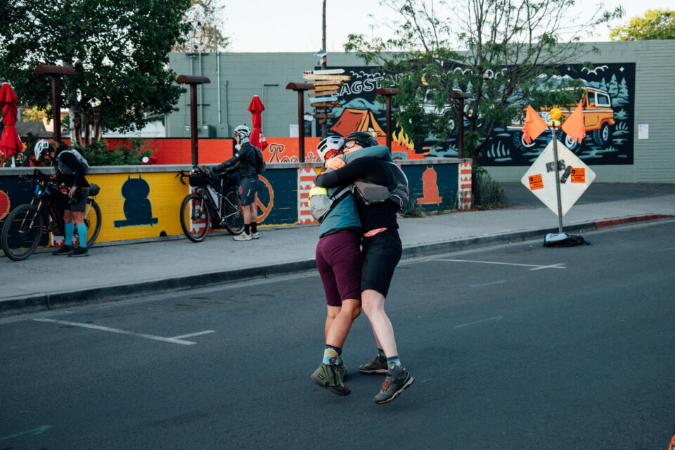
As riders in the 2026 Pinyons and Pines race in Arizona begin their third day, Wyatt Spalding shares a detailed breakdown of this year’s route and photos from the first two days of the event. Dig into his recap and browse a stunning photo gallery here…

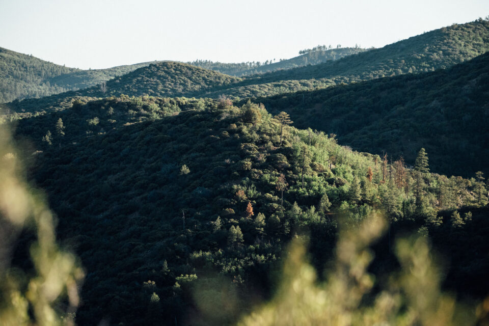
At 6 a.m. last Thursday, a group of bikepackers departed from Flagstaff Bicycle Revolution, taking on the newest edition of the Pinyons and Pines Bikepacking Race. This year, the route is one of the longest yet, at 413 miles with a daunting 40,000 feet of elevation gain. This version may be the most difficult to date, too, featuring massive climbs from fields of cacti up to thick ponderosa forests. The route also has a hefty dose of techy singletrack and chunky jeep trails. Challenges aside, this year’s route takes riders to some of Arizona’s most spectacular views. It’s truly a fantastic display of the ecological diversity that makes the state such a special place.


Out of the many challenges that racers face on rides like these, this year’s combination of scorching heat mixed with sustained climbing seems to be taking the biggest toll. Riders frequently find themselves riding up long, exposed climbs in the hottest hours of the afternoon, with little shade and few water sources along the way.
It seems this year’s course is always throwing something at the participants, whether it’s steep grades, scorching temperatures, technical and exposed terrain, challenging resupplies, mechanicals, or all of those combined at once. To put these challenges into perspective, I laid them out in order:
Casner Mountain
At roughly mile 37, after a fairly steep hike-a-bike, the route drops off Casner Mountain. The jeep road features extended grades of -15% and is a true test of your brakes and bike handling skills. The surface is never smooth; rather, it is quite the opposite, at times almost entirely composed of small boulders. After dropping roughly 3,000 feet off the Sycamore Rim and lower into Cottonwood, riders soon notice the increase in temperature and the lack of trees to provide shade.
Mingus Mountain
After a resupply in Cottonwood, riders begin the ascent of Mingus Mountain at mile 66. You start in the desert, surrounded by shrubs and cacti, and climb back into the dense forest. The 15 miles of singletrack are very exposed, steep, and overgrown, which slows things down. Eventually, riders make it back into the trees, and the temps are a few degrees cooler, but there is still significant climbing left. From Cottonwood, it is about 23 miles and 4,500 feet of elevation gain to the top.
Crown King Ascent
At mile 135, riders find themselves in the desert once again. Saguaro cacti can be seen perched on every hill. If it’s midday, it’s probably 90ºF or hotter, and there is minimal shade. The route begins ascending into the Bradshaw Mountains and onward to Prescott, Arizona. After 17 miles and about 3,200 feet of elevation gain, riders arrive in Crown King, which offers a general store (with very limited hours) and a few vending machines. Once here, what remains is 34 miles and 4,000 feet of climbing before arriving at the Prescott Circle Trail, which circumnavigates the city of Prescott on some fantastic singletrack.
Mt. Union Mandatory Summit
After 56 miles of Prescott singletrack, riders are closing the loop and approaching the out-and-back to the top of Mt. Union. It is only about 8.5 miles and 1,000 feet of climbing, but it’s also 250 miles in. I’d imagine that an out-and-back summit at this point of any kind could be psychologically straining. However, the top provides amazing views, and the next 35 miles trend mostly downhill.

The Final Ascent to Flagstaff
At mile 330, the route leaves Camp Verde and begins ascending back toward the finish in Flagstaff. Riders are once again in the high desert, and if caught there midday, it will be warm and exposed. While the steepness is less severe here, it is far more extended as it trends uphill for 52 miles. At route mile 385, riders are atop Mormon Mountain with 28 miles to go, trending mostly downhill to the finish.
This year’s event provides a constant contrast of environments as riders bounce between cool forests and sweltering deserts. There are significant stretches of remote terrain with large gaps between resupplies at times. Despite the list of difficulties, this year’s route showcases some of the best riding Arizona has to offer and offers a brilliant tour of the state’s vast ecological diversity.


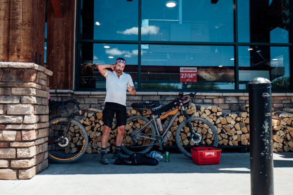
As of Friday evening, riders remain spread out across the course, with men’s leader Timon Fish likely to finish in the early hours of Saturday morning. He is followed by Jeff Kerkove, who is roughly 10 miles behind. Sarah Didier leads the women’s race, closely followed by Katie Smyth and Gwen Cameron. Nico Francis, in the non-binary field, is staying the night in Crown King and will be heading to Prescott in the morning. The scratch list continues to grow, highlighting just how demanding this year’s route and conditions have been.
2026 Pinyons and Pines coverage supported by

Further Reading
Make sure to dig into these related articles for more info…
Please keep the conversation civil, constructive, and inclusive, or your comment will be removed.