
Kurt Refsnider is riding the full length of the new Orogenesis route, dubbed “the longest mountain bike trail in the world.” This third installment covers his miles through northern California and some of his favorite riding on the route thus far – from the Great Basin’s arid edge, through the Lost Sierra, the comparatively flowy Lake Tahoe area trails, the Owens Valley, and the high Eastern Sierra.
For most of the final week in Oregon, I had been struggling to keep my attention and focus on the trail. My thoughts kept wandering ahead to California. I take a bit of pride in my ability to remain present and find enjoyment in tough situations and on the hardest of trails, but I was struggling with that amidst all the deadfall, the persistent late summer heat, and general fatigue on those southern Oregon trails. I knew the northernmost miles of California were almost entirely 4×4 roads, gravel, and rail grade to link from the Oregon Timber Trail to the northern end of the Sierra Nevada – miles which likely would be entirely free of downed trees! I also was going to get to see my partner Claire one week into California, providing some very strong motivation to keep moving steadily. So when I caught sight of an inconspicuous little sign reading “state line” bolted to a still-standing tree, I just had to stop, celebrate, and let some relief wash over me.
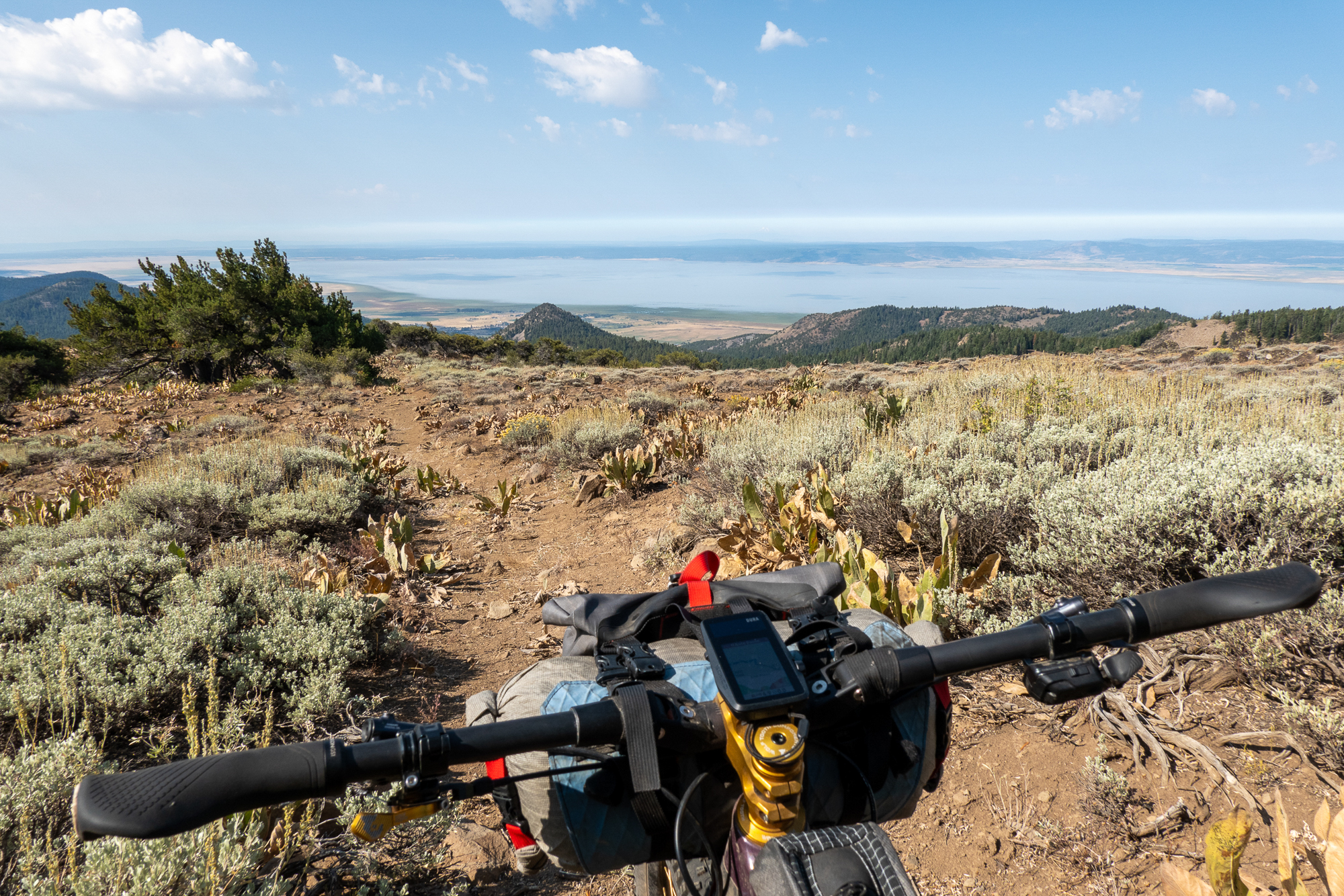
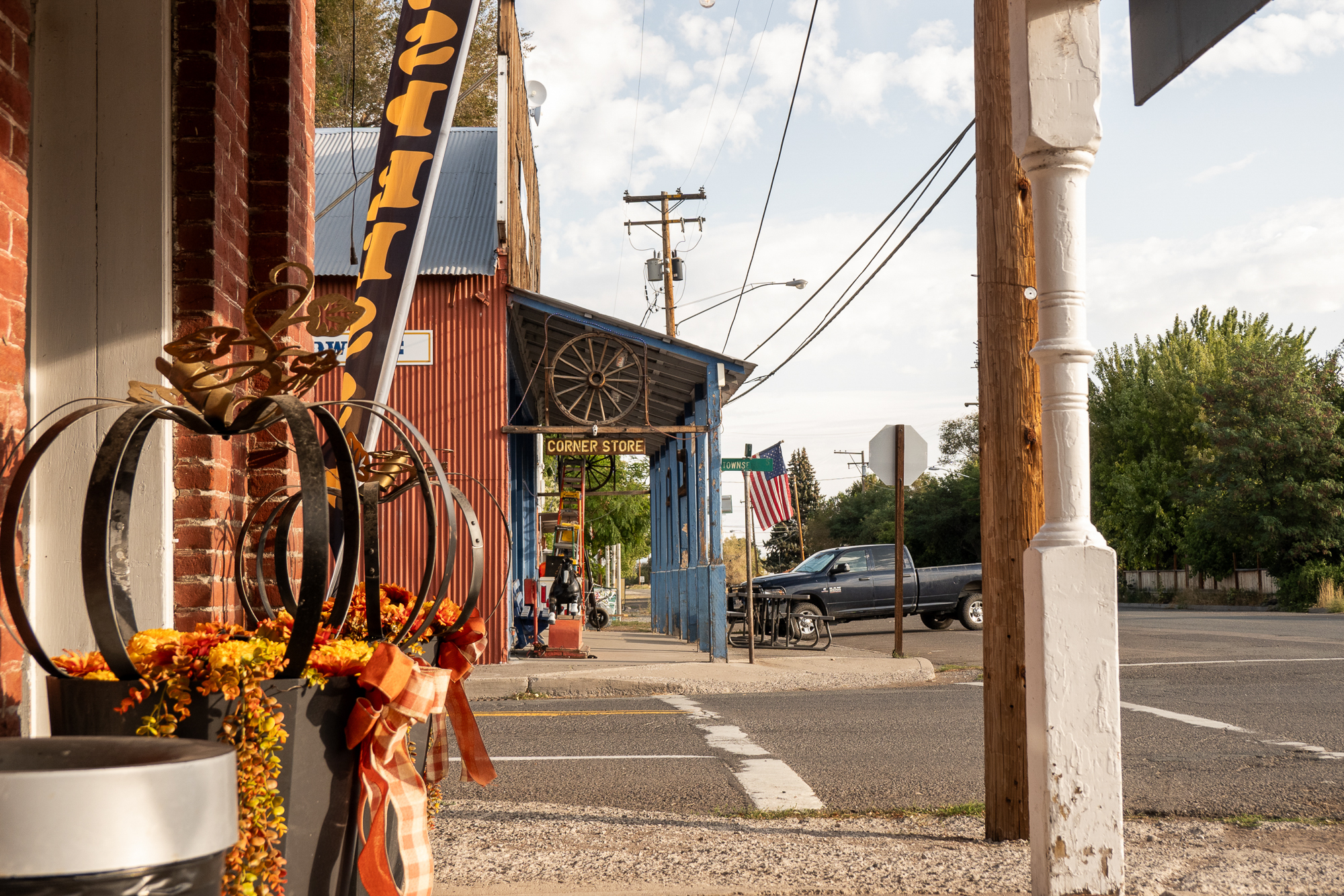
The deadfall-strewn singletrack promptly gave way to rough old 2-tracks past derelict log cabins and collapsing adits of the High Grade gold mining district. The route continued south along the crest of the Warner Mountains with long views across broad valleys filled with shallow lakes, the peculiar-to-me combination of basin and range topography meeting Pacific moisture. I dropped into the friendly crossroads town of Cedarville and enjoyed a couple conversations with local folks over coffee the following morning. They were eager to hear more about Orogenesis and seemed excited that the route passed through their community, a common theme I encountered along my journey.

I exited the mountains on the abandoned Modoc Line rail grade, a future rail trail that isn’t really quite a proper trail yet. Seventy miles of sometimes overgrown and often soft pedaling once again tested my mental fortitude. Expectations can be everything, and I had been optimistically looking forward to fast, smooth rail trail miles rather than tedious 7-mph miles. “Patience, patience,” I reminded myself as I stared ahead at a low peak I’d likely meander past in another four or five hours; hopefully the spring I found on old maps below that peak would have some water.
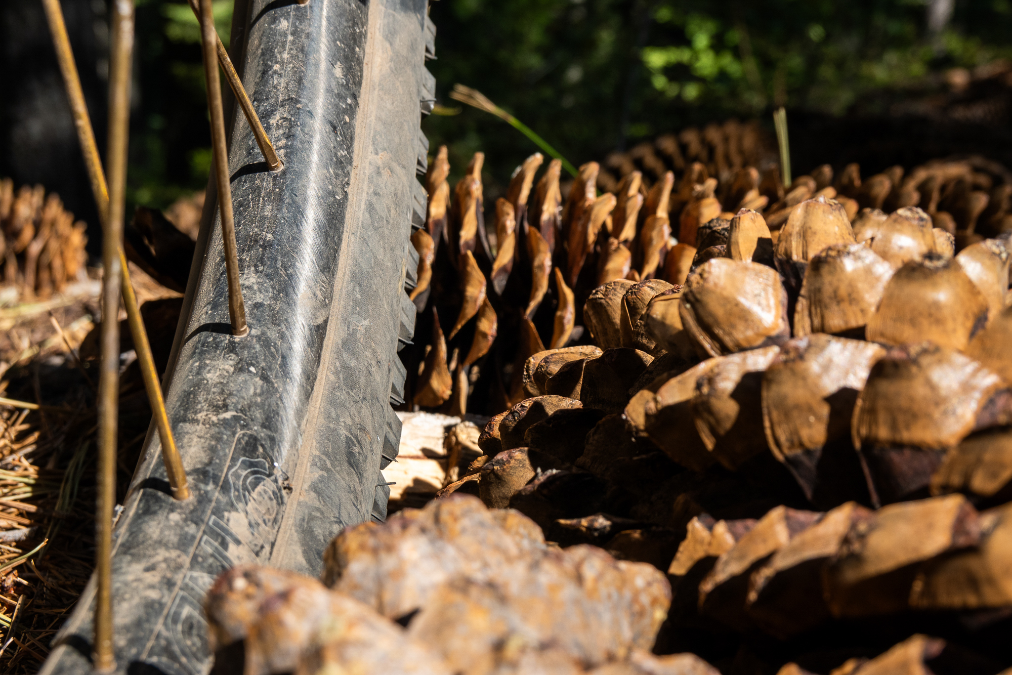
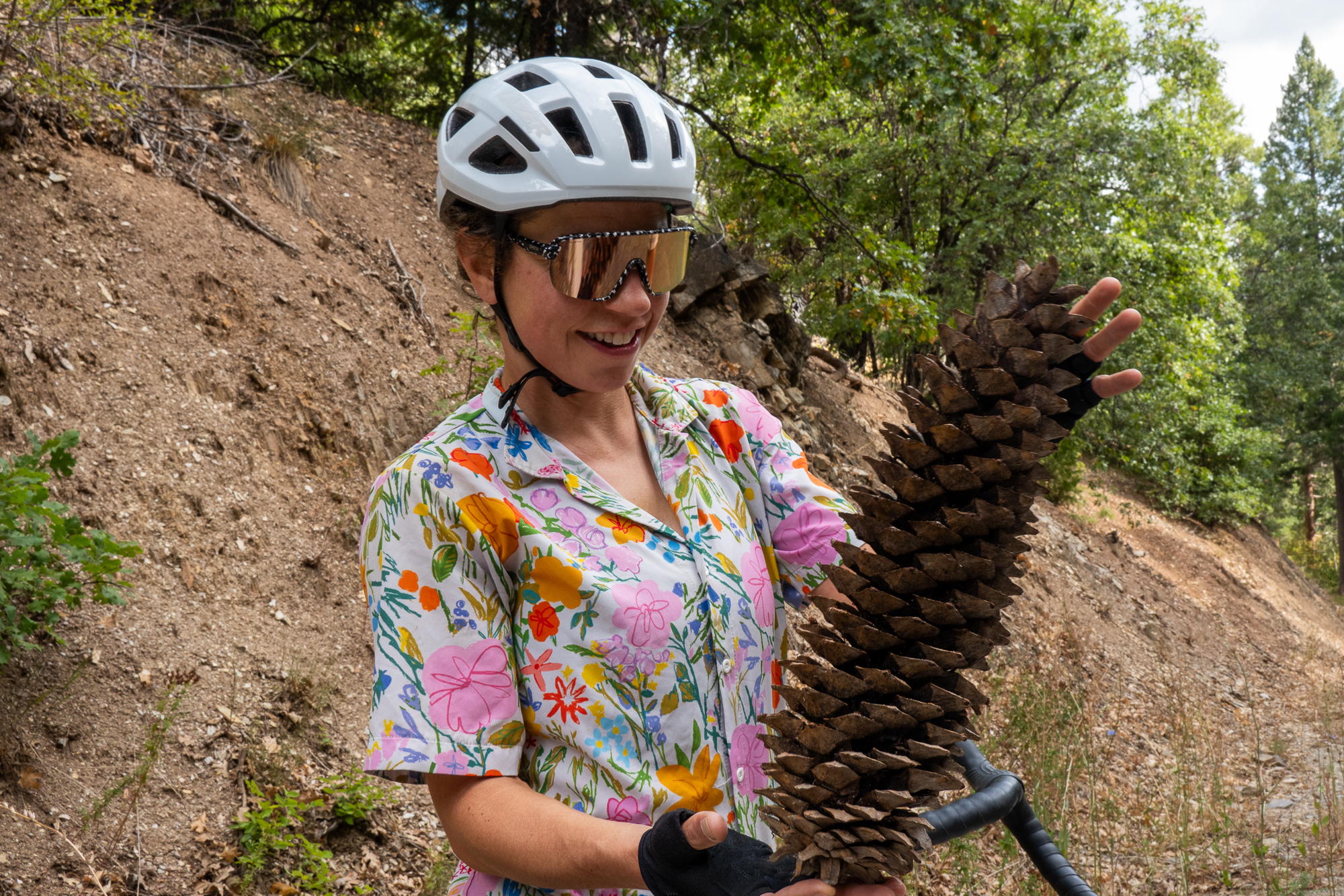
Less than 24 hours later, I found myself meandering through a forested canyon on entertaining singletrack just outside of Susanville, and from there I climbed winding logging roads over first gentle ridges of the Sierra. The tough miles of southern Oregon and the Modoc Line now felt distant in all senses. After another 24 hours, I was riding out of Quincy with Claire, struggling to keep up as she zipped ahead on her gravel bike. Fortunately she kept stopping to marvel at the enormous sugar pine cones.
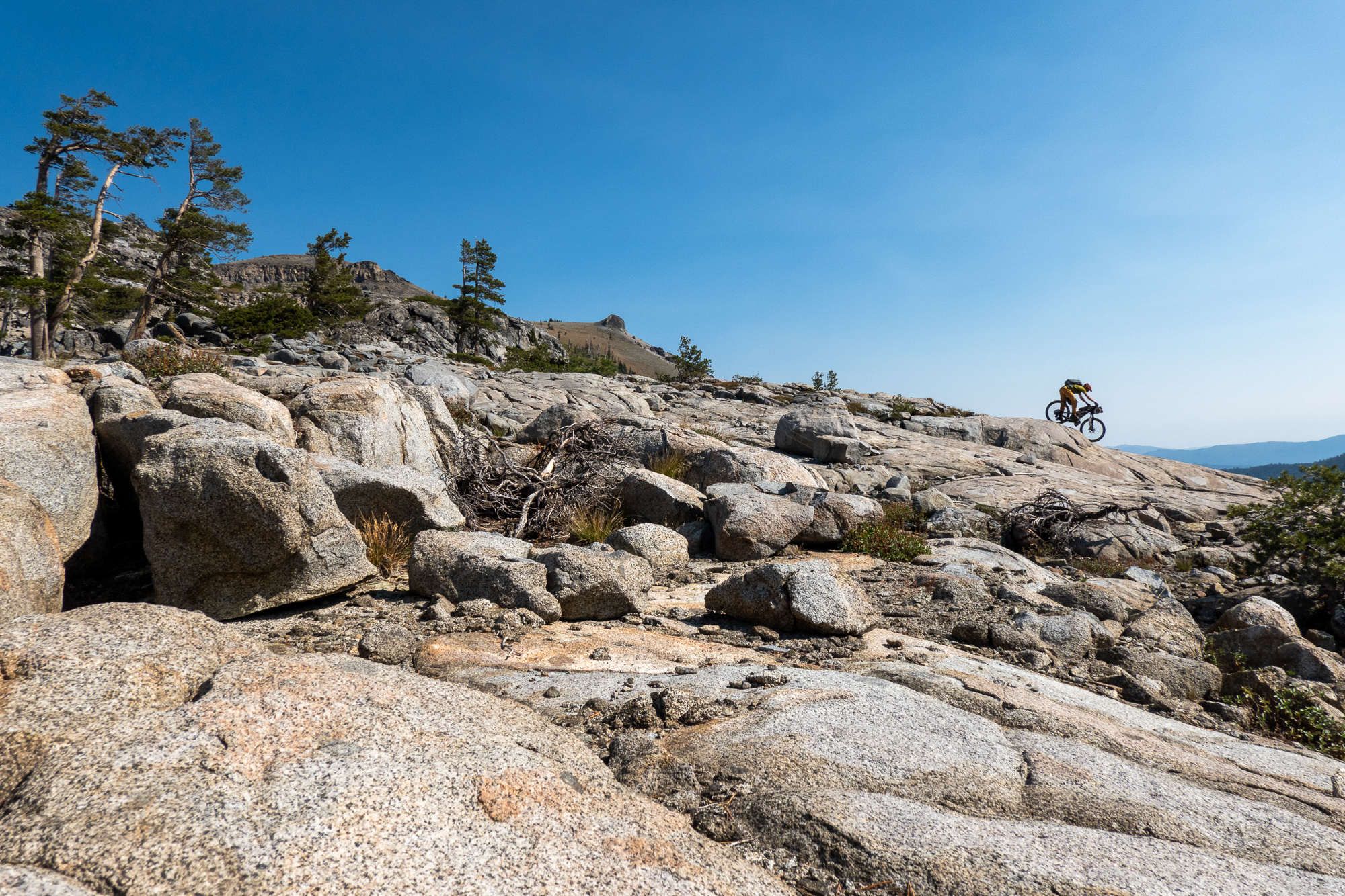
Striking Gold in the Lost Sierra
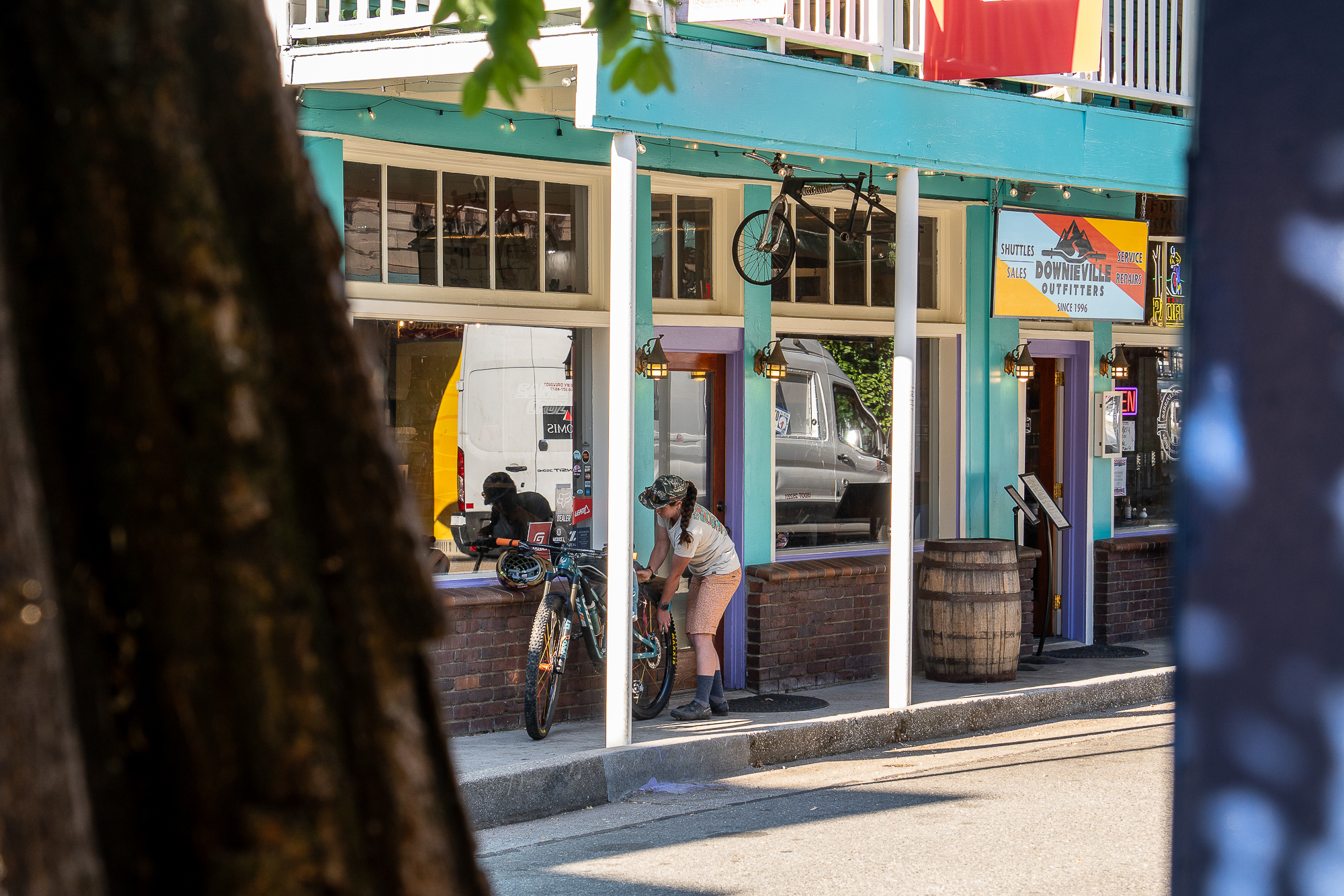
Virtually the entirety of the Orogenesis route has been new to me, so the familiarity I felt in the Lost Sierra was energizing, especially since I knew the riding was fantastic. The prior summer, I had spent a couple weeks in the area. I bikepacked from Quincy to Downieville with Kait Boyle and her husband Will, raced the Downieville Classic, helped with Orogenesis scouting for the best passage through the region, and then stayed a week longer than planned because I enjoyed the riding so much. This time, I lingered again for a week to rest up, catch up with Claire, do some work, and replace worn parts on my bike.
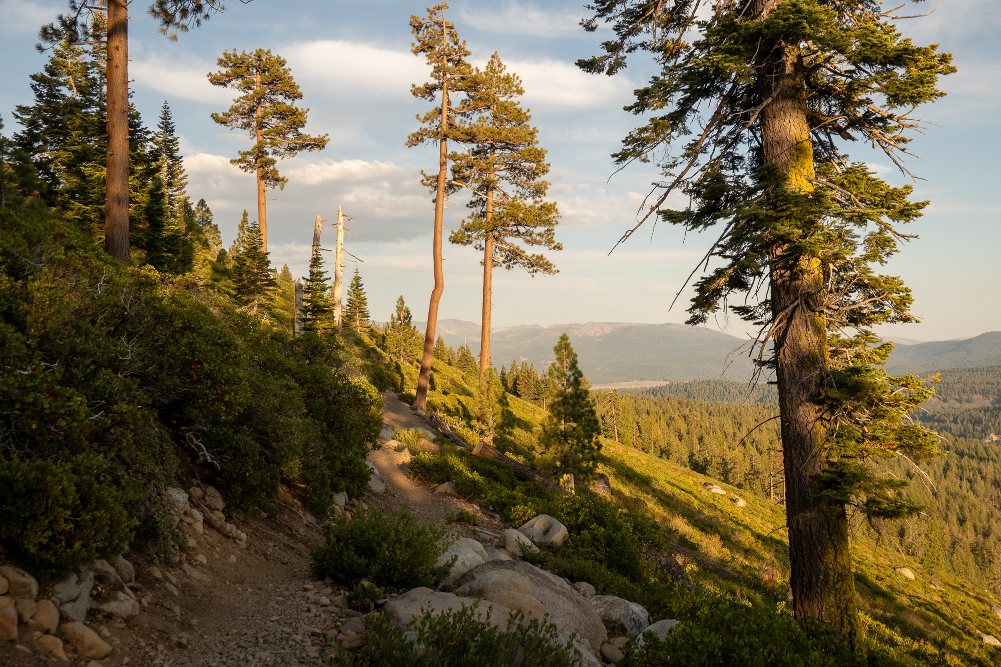
Truckee, Tahoe, and Beyond
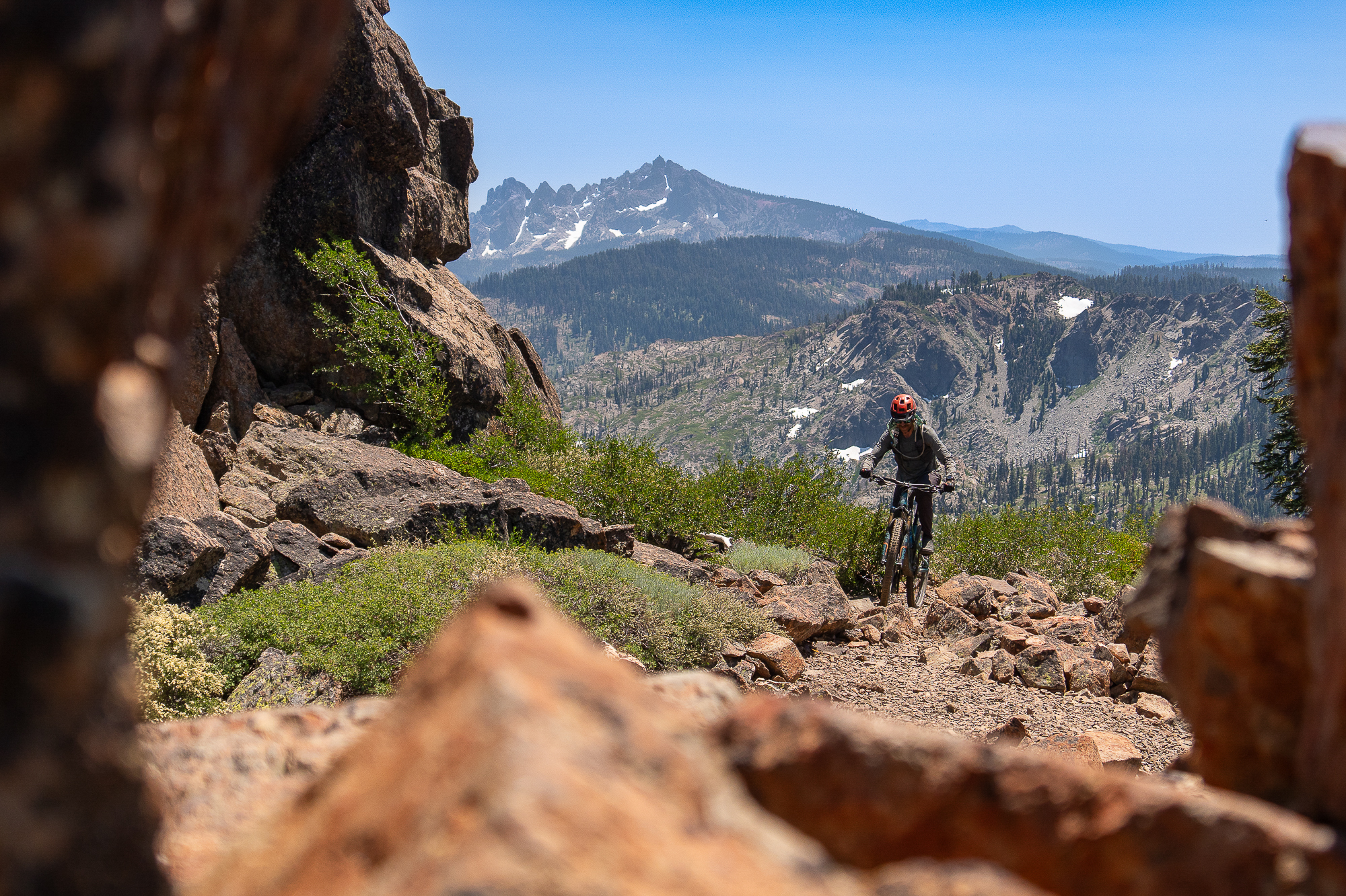
That week passed in the blink of an eye. It was a relief to be back out on the trail, although leaving wasn’t necessarily easy. But I was eager for the trails ahead – lovely trail past the Sierra Buttes, the legendary Downieville DH, and then the Sierra Camino segment created by Chris McNamara linked together days and days worth of world-class trails from Downieville, past Truckee, Lake Tahoe, and all the way to Markleeville. Most of these trails are well-traveled, regularly maintained, and non-motorized! Autumn suddenly arrived, too – cool sprinkles, some yellowing in aspen groves, and a brisk breeze. It was all so invigorating. The paucity of photos on my camera from that week belies how much I was enjoying myself. Those miles were one of the highlights of the entire route thus far, so much so that I even added some extra time on the Tahoe Rim Trail because I wanted more. I was also treated to a night in South Lake with the entire Board of Directors for the Orogenesis Collective and friends, joyfully celebrating the trail over tacos and stories.
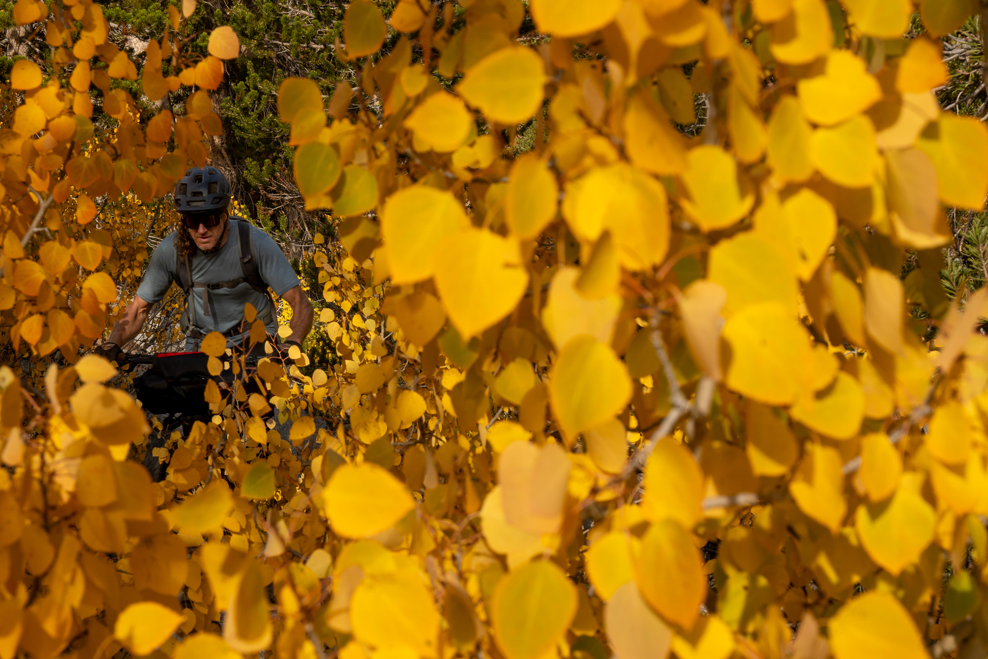
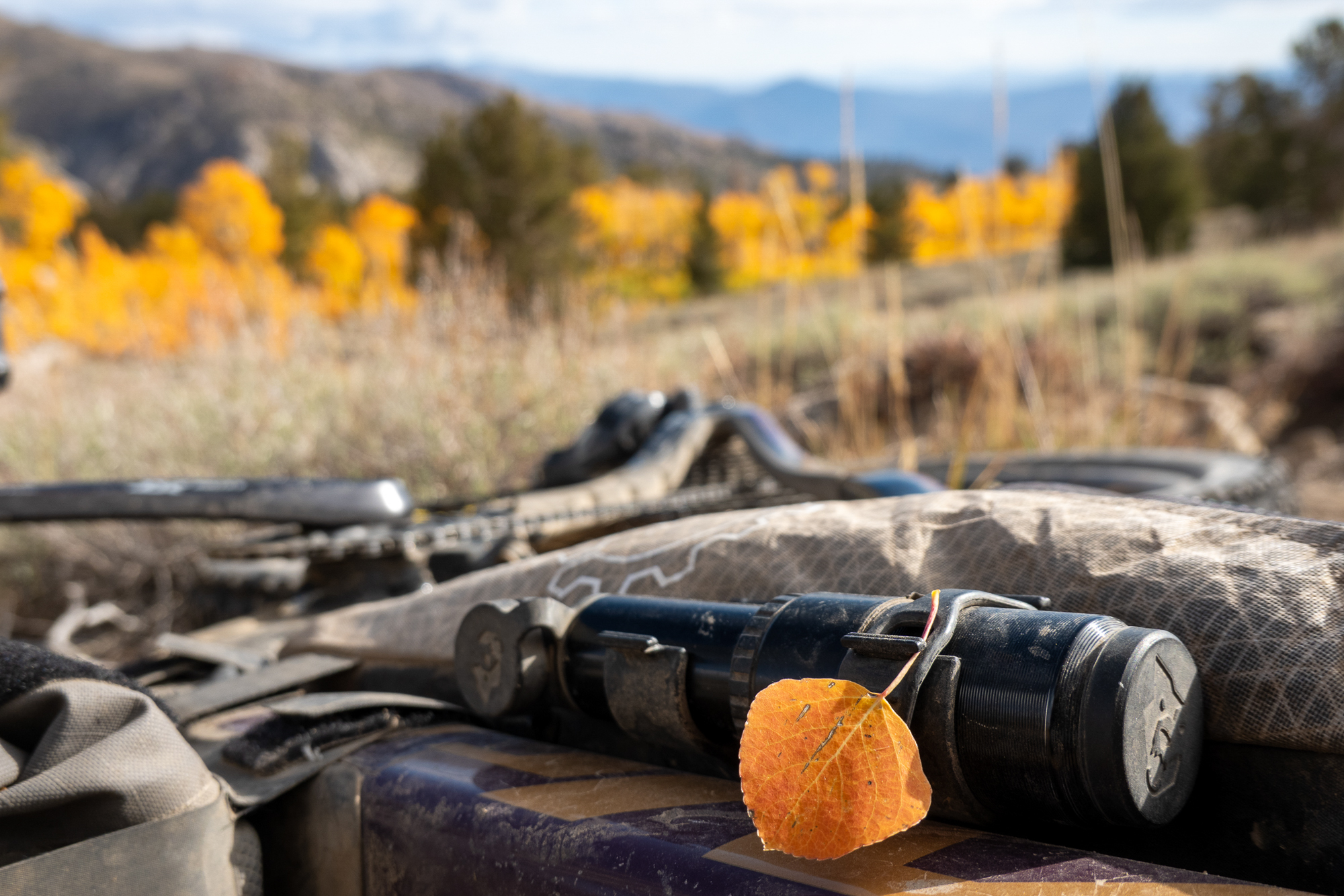
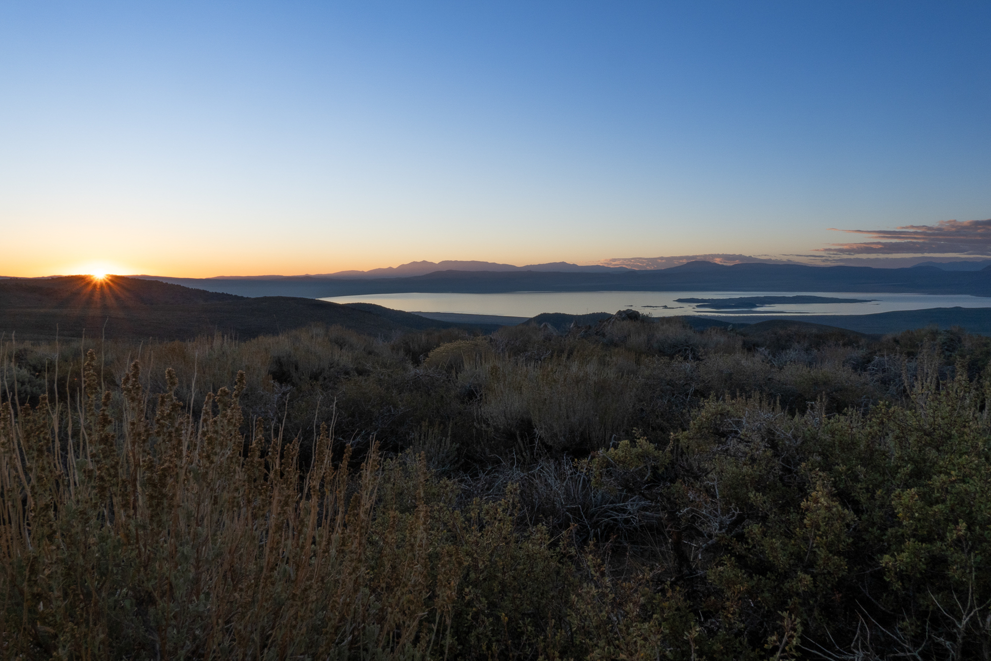
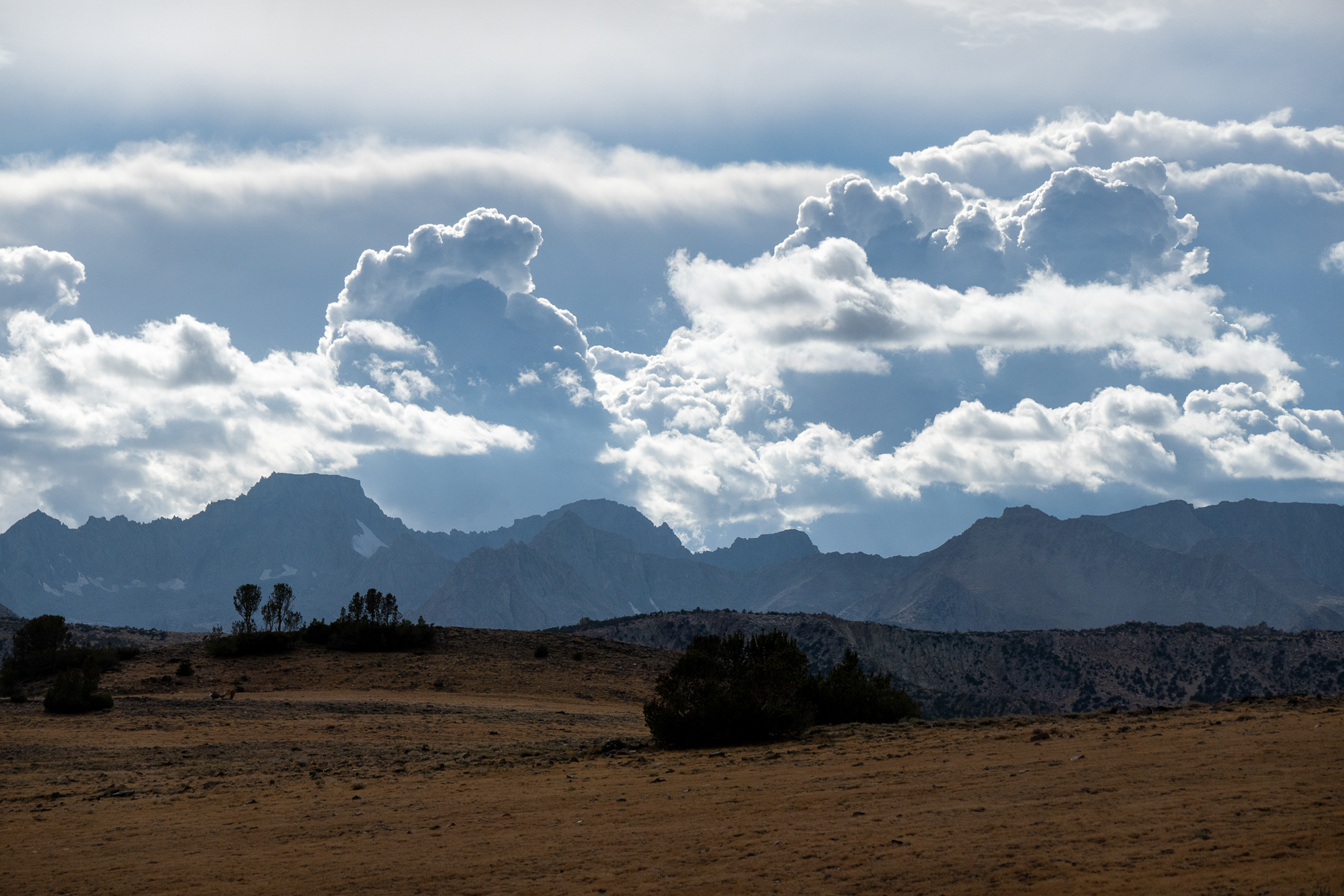
A few years ago, photographer Eddie Clark excitedly shared some plans he had to follow autumn that year, chasing glowing foliage toward progressively more southerly mountains over the course of several weeks. Now it felt like it was my turn to do that as I bounced south through the eastern Sierra. The route alternated between high-elevation riding among the peaks and low valley miles where Wilderness areas prevented connectivity above. No matter the elevation, the colors were vivid.
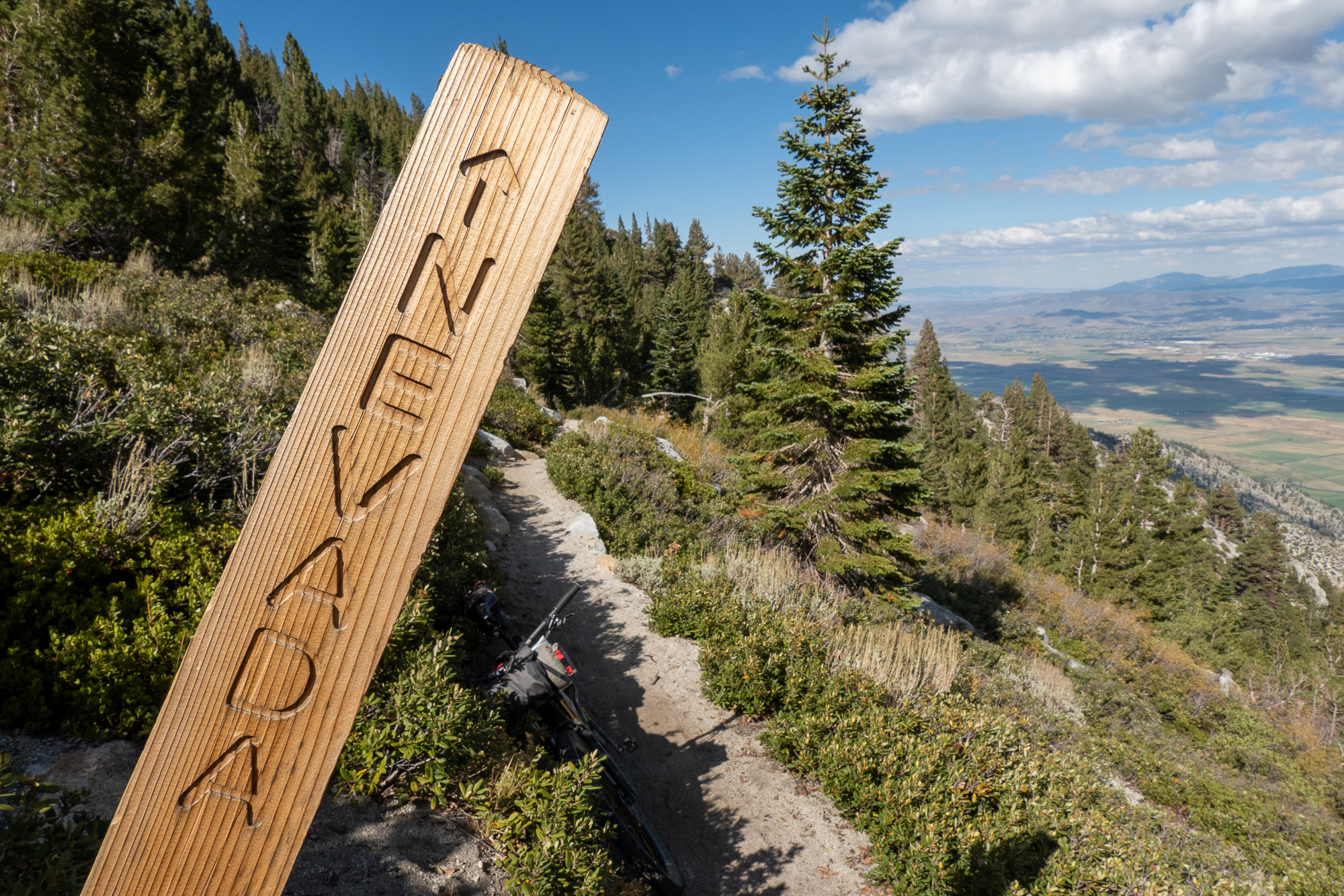
The Eastern Sierra
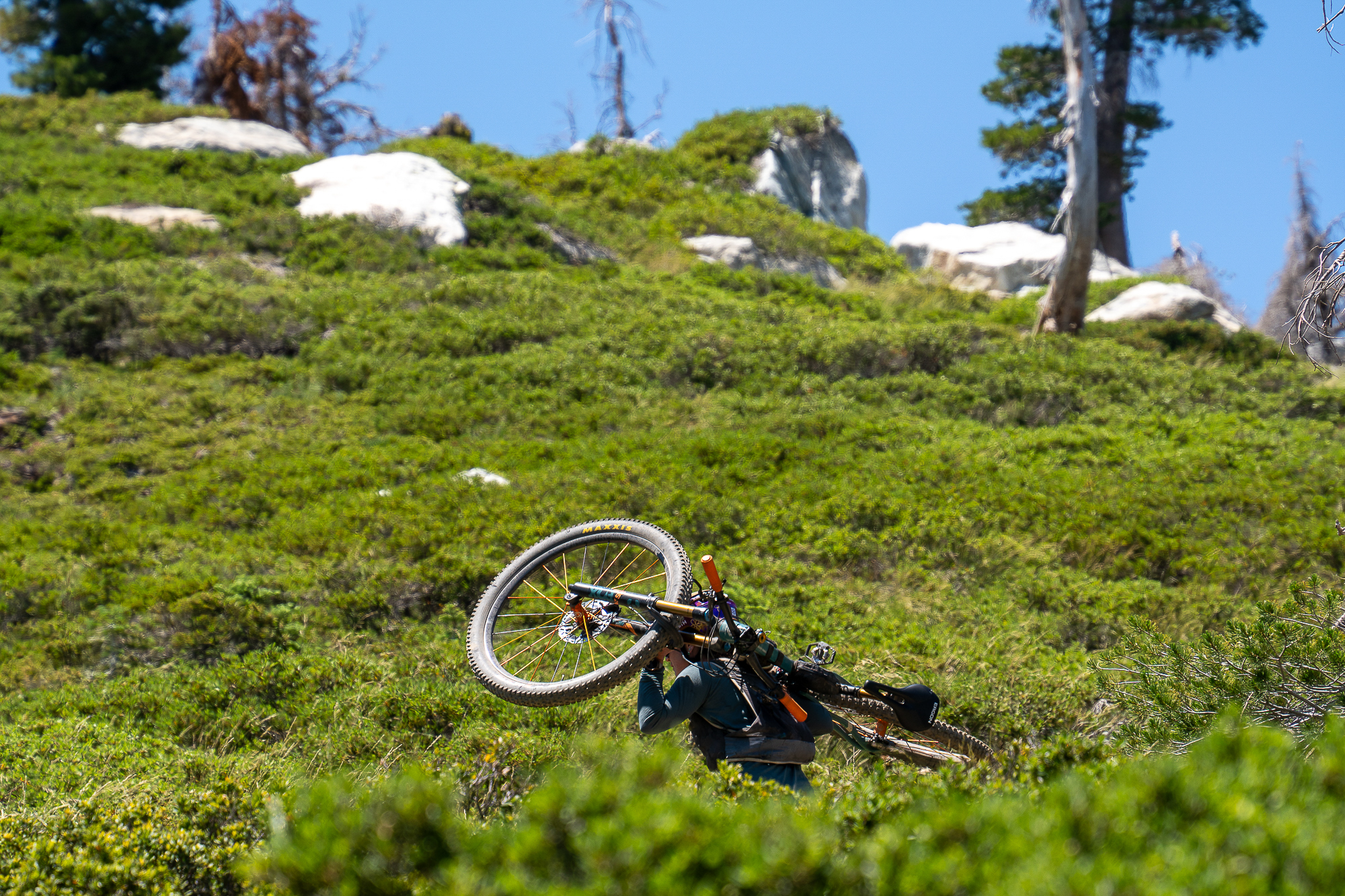
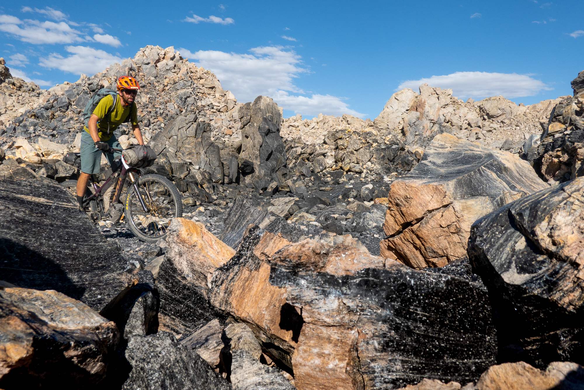
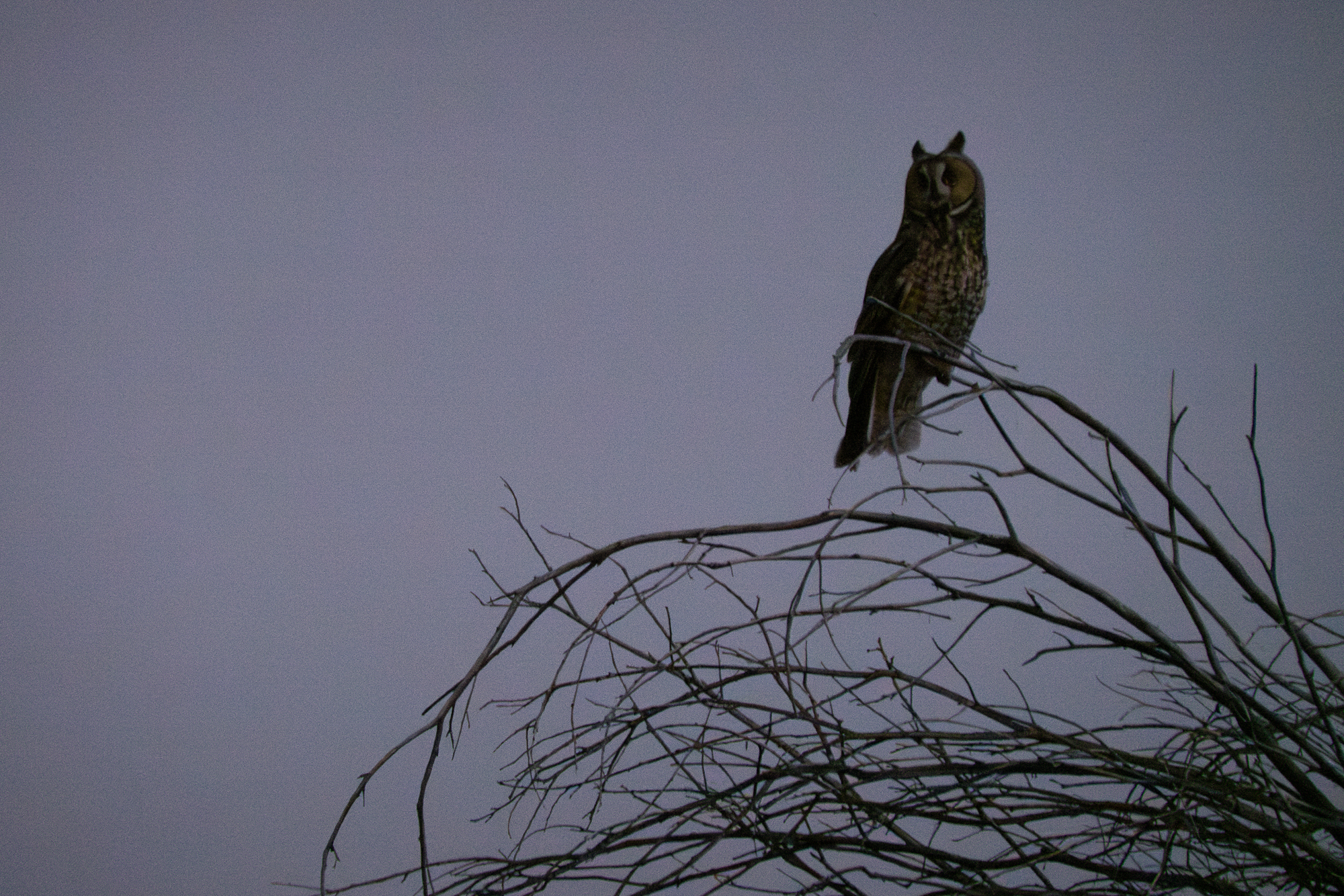
Orogenesis has two alignments through this part of the route: the Sierra Teleli on the west side and this one on the east side of the Sierra. The arid high country of the eastern Sierra drew me to that option, and the diverse and captivating landscape surprised me day after day. The lighting, lush grassy draws amidst sagey hills, otherworldly domes of obsidian, a flock of long-eared owls, and surprise visits from local riders. The days passed quickly, accentuated by the steadily-lengthening nights.
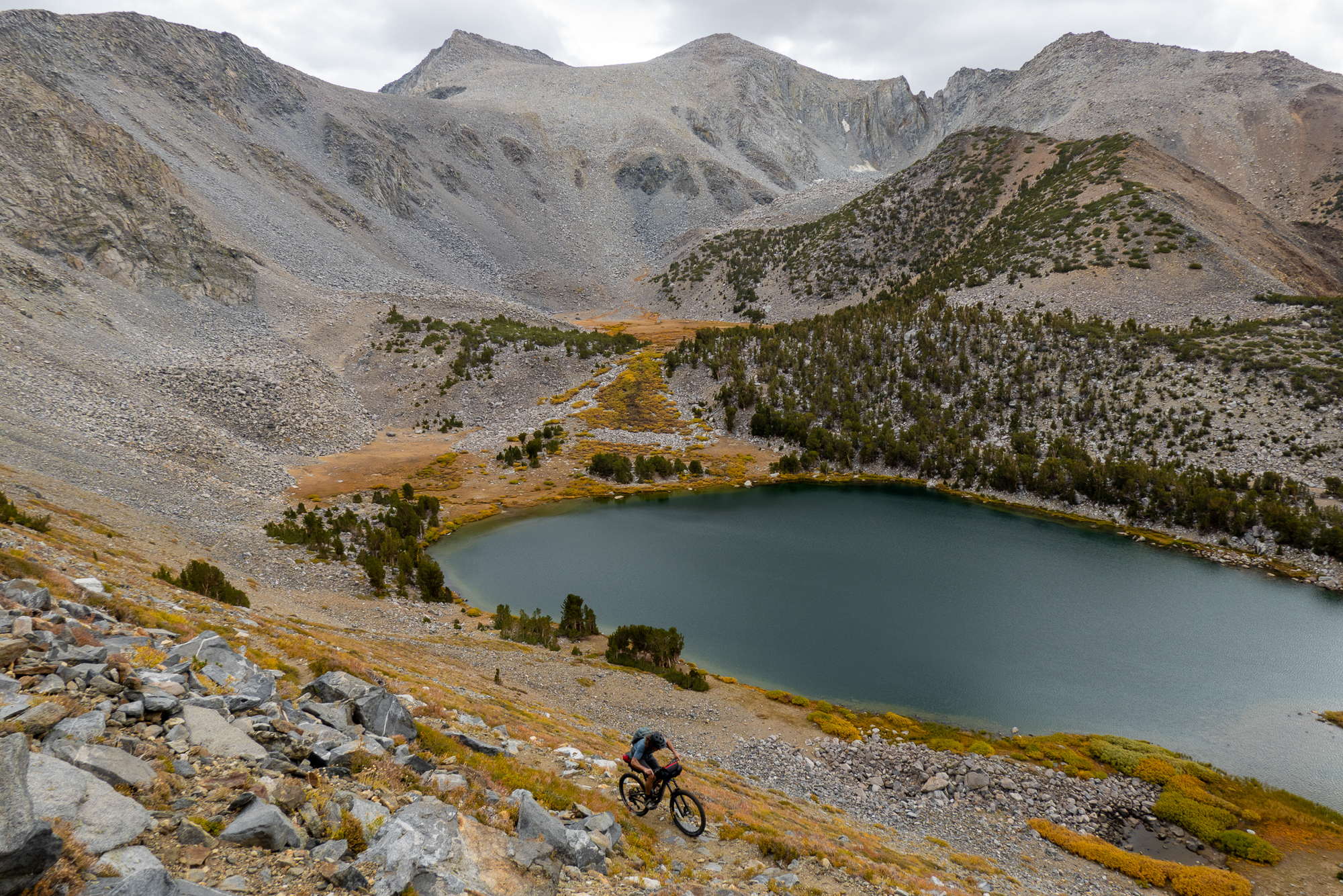
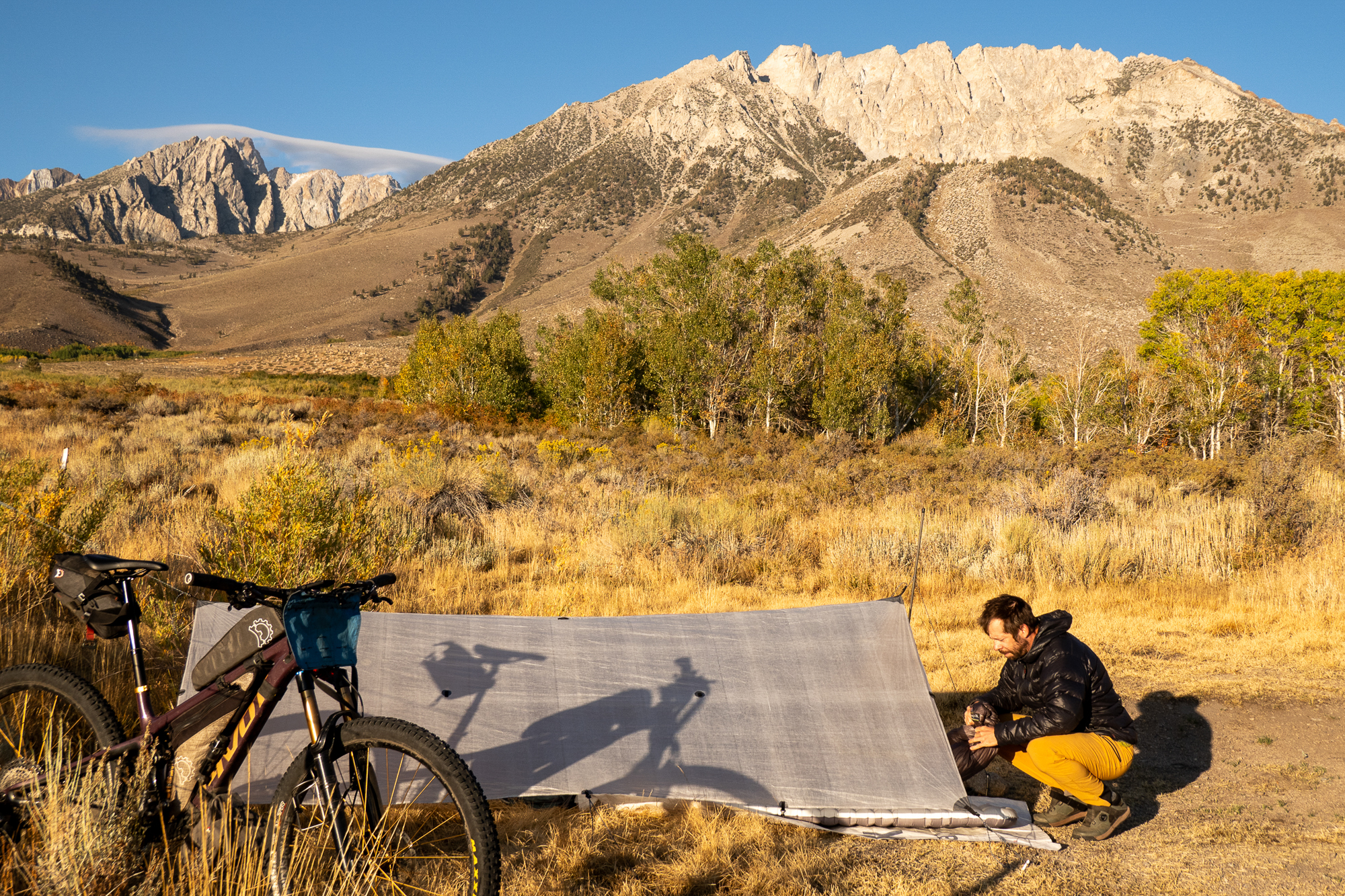
The longest single ascent on Orogenesis is above Bishop where the route climbs roughly 7,000 feet up past Green Lake to Coyote Meadows for one last foray into the alpine proper. Not coincidentally, the longest rideable climb in the U.S. outside of Hawaii is on the opposite side of the valley, a 10,000-foot ascent up into the White Mountains! Ken Etzel joined me for a night on his backyard trails and shared hours of stories of adventures in the surrounding mountains. I relish feeling the love individuals have for their local trails and terrain – that passion is powerful and contagious. A cold night up at 11,000 feet gave way to warm morning sun on towering granite peaks, and we laughed our way down into the next valley to the south on one of those trails proved to be surprisingly fantastic despite very few signs of any recent traffic.
History Repeats
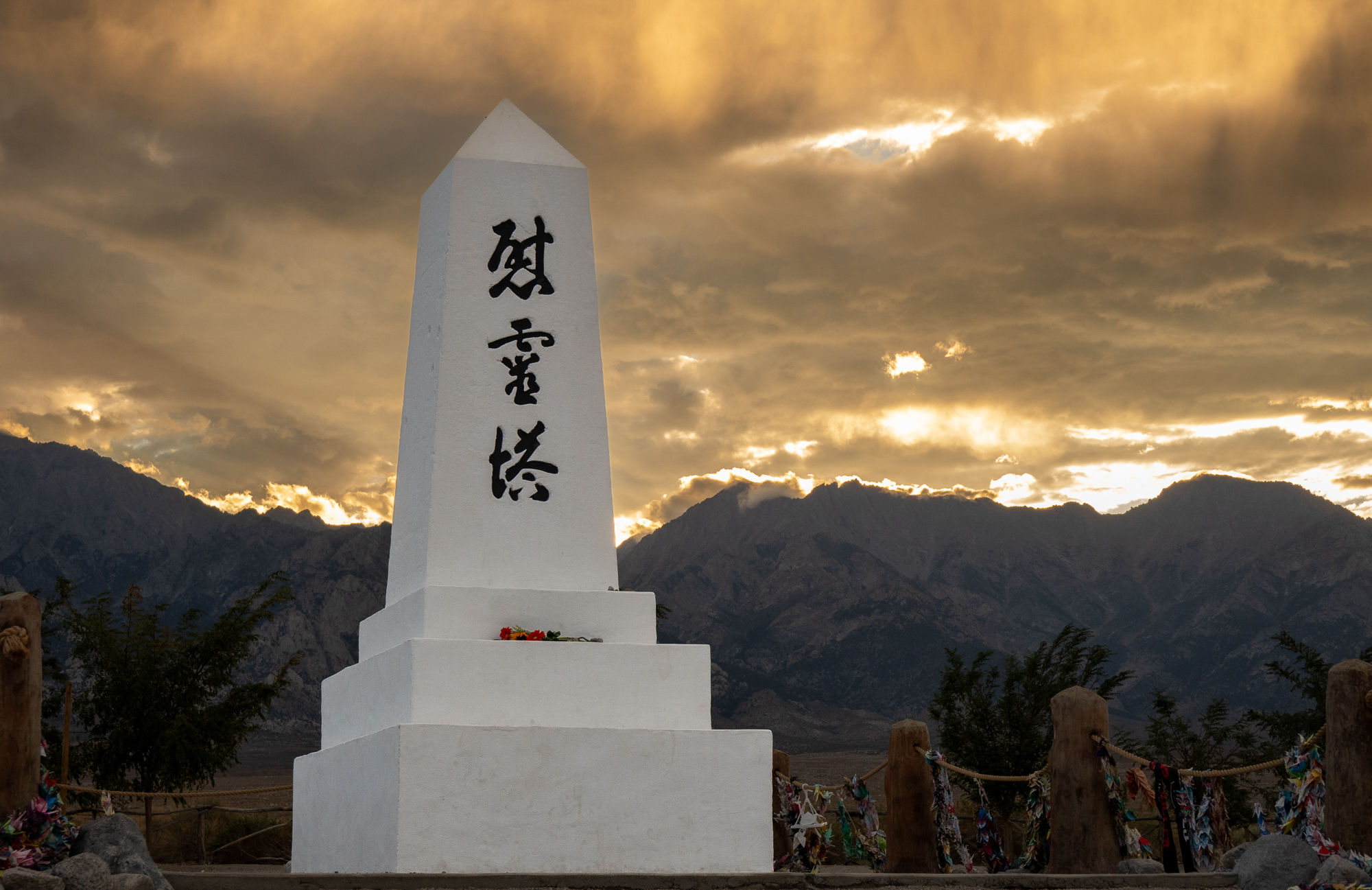
In the heart of the Owens Valley, I passed the site of the WWII-era Manzanar concentration camp, where more than 10,000 Japanese Americans were incarcerated, forcibly relocated simply because of their heritage. I pedaled on through a somber evening steeped in subdued light and reflected on such a terrible history from some 80 years in the past, and how echoes of those years are now reverberating with renewed vigor.


Cadillac Desert
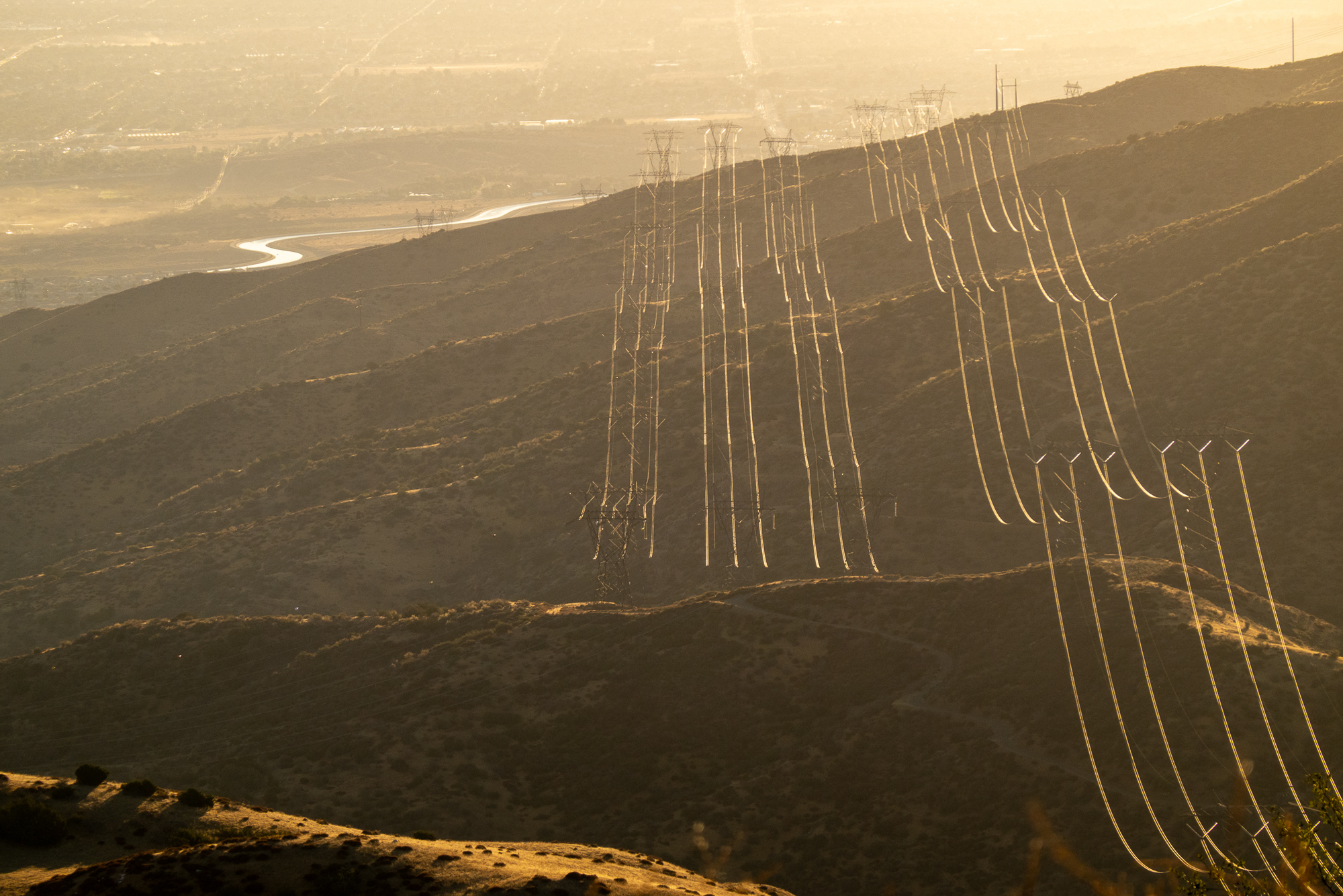
The southern Owens Valley is dominated by the thirst of the distant Los Angeles metropolis. Early in the last century, the city bought up farmland here, often aggressively, and constructed the 400-mile Los Angeles Aqueduct to carry harvested water from the valley and the mountains above to the growing city. I followed the aqueduct as it wound its way south, in places fortified by concrete walls and barbed wire and in other places invisibly beneath ground.
The Cannell Plunge
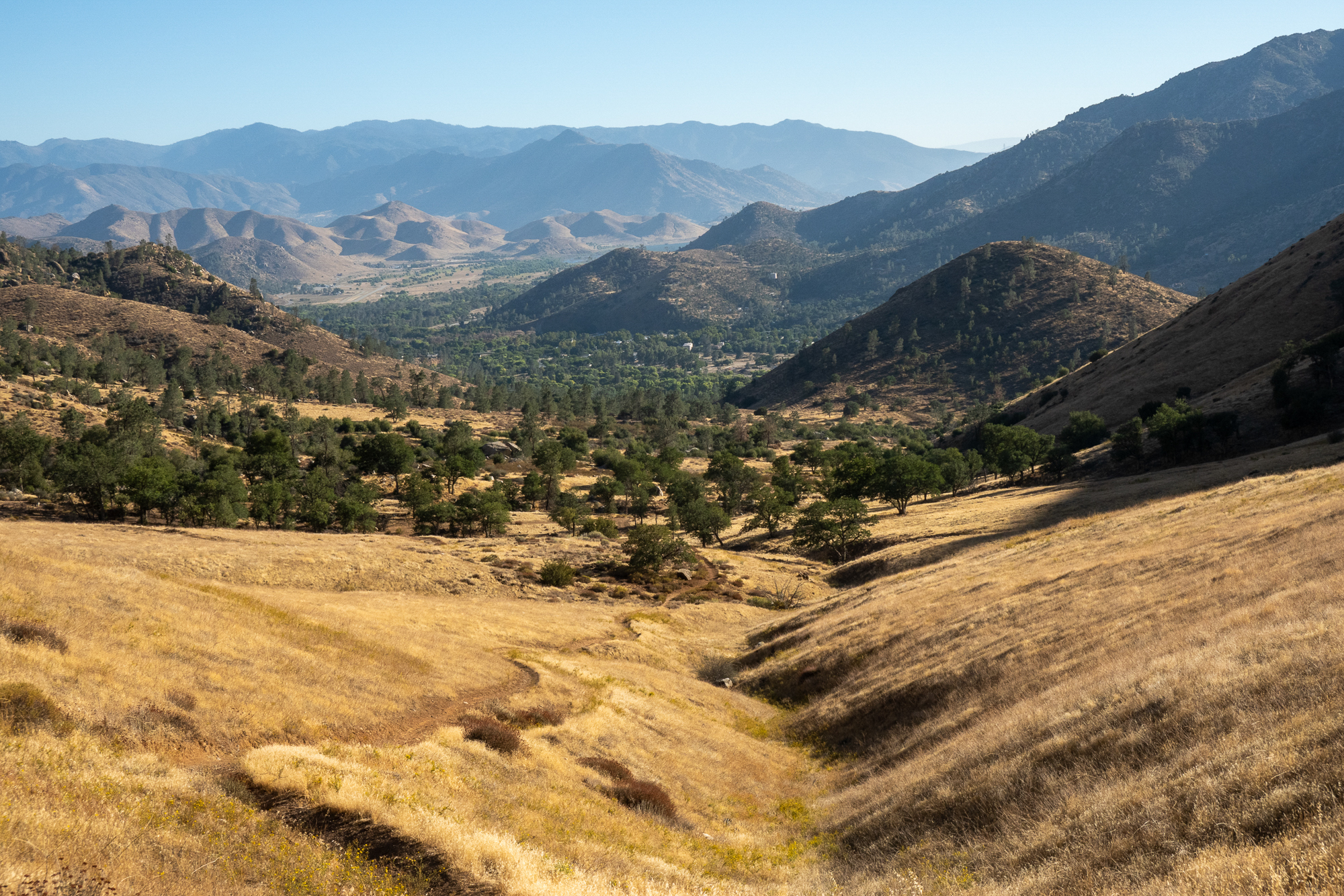
The final miles of this section were across the Kern Plateau on popular moto trails through pine forests and scattered meadows. Near Kernville, I had noticed the route line plummet nearly 5,000 feet on what maps suggested was singletrack. I expected rough, whooped-out moto trail, but as I reached that section, a plethora of mountain bike tracks joined in from a road crossing, and I was treated to what turns out to be an often-shuttled backcountry-to-town bike ride: the Cannell Plunge! I laughed my way down it, pausing at one point as I rounded a bend and stretched out before me was what, in my own head, looked like SoCal – dry, rugged mountains climbing steeply from a reservoir at their foot. Those were the rather unassuming Paiute Mountains, and I didn’t realize it in that moment, but they’d prove to be the crux of Orogenesis in California.